Hiking, the Hard Way
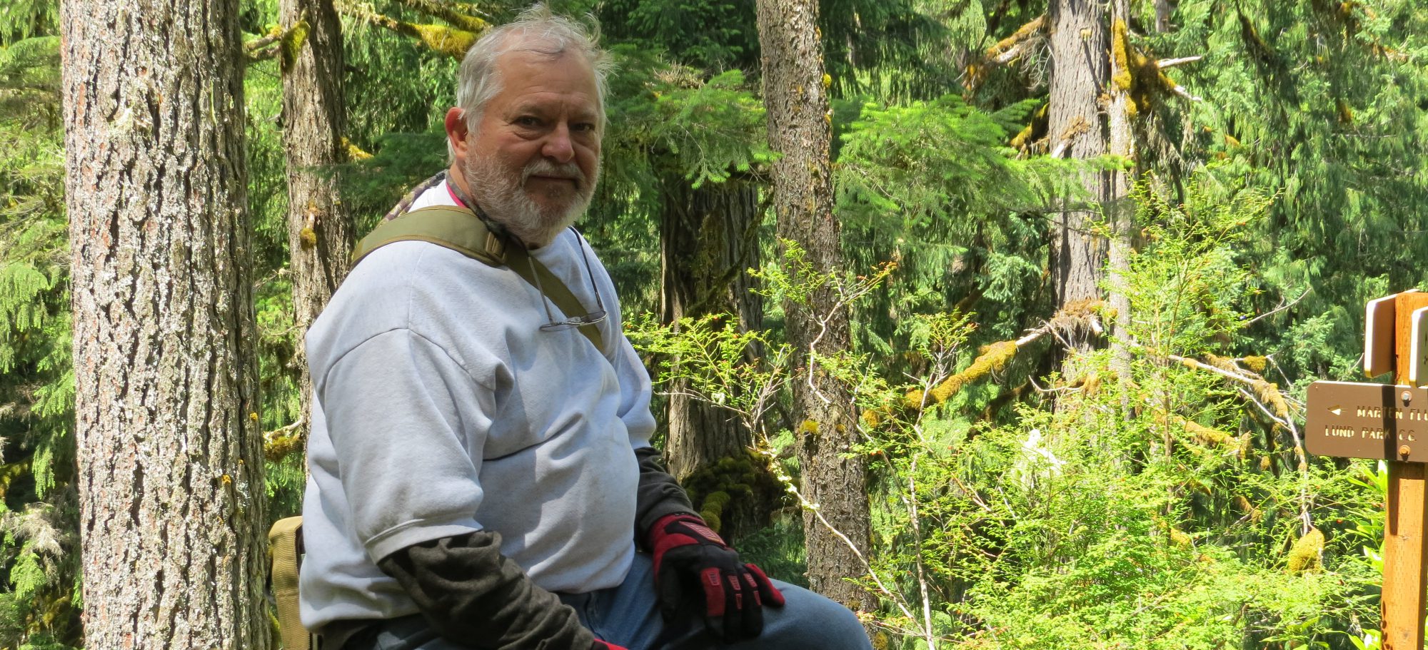
Her I am getting ready to head out on my latest hike with my trusty companion, Pepper, 150 pound Labrador with Rottweiler and Mastiff on his dad’s side. He also had growing pains when a puppy and has not grown completely out of it yet, but he does not hesitate in coming along and it good for him as I have not 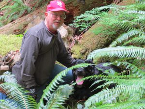 been able over the last couple of years to excersize him properly. Little did we know that this hike was going to be almost as bad as my walkabouts in ‘Nam.
At any rate the trail starts to the left at the first hair pin to the right of the Noon Day Trail. About one quarter of a mile from where the Noon Day takes off from Champion Creek Road.
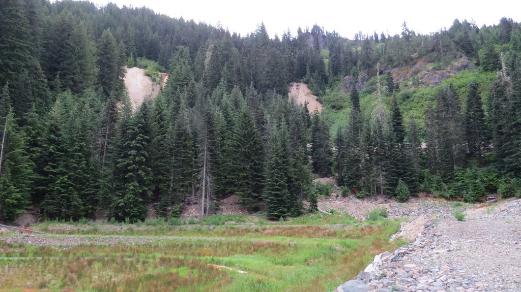
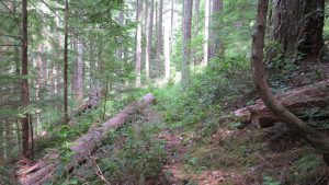 Here is a section that looks easy and is the start of the trail. The trail is not an improved trail and does not get any upkeep from the Forest Service. It is also not on any maps that I have found.
 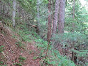 You can see the log across the trail and it only gets worse. At the far end of this one you can see some stuff we have to climb through.
This next one is some of what we were experiencing and this not the worst section. You can see more of everything we climbed through by clicking on any picture which will take you directly to the complete album.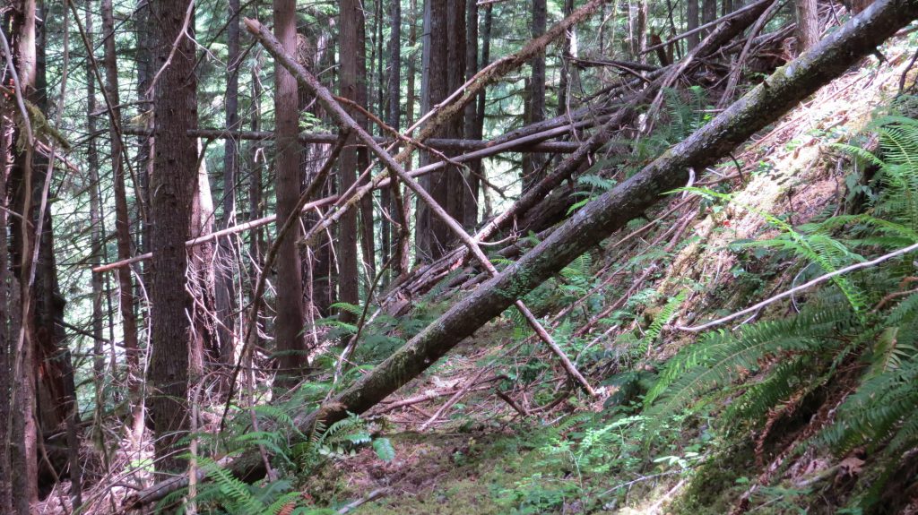
Leaving the Bohemia Mines area we passed over Champion Saddle and on down Sharps Creek which is other wise known as Hard Scrabble Grade. If you travel into this area please make sure your car (better SUV) is in good shape, tires are good and have standard emergency supplies available. If you are going down your brakes will get hot and going up, engines will get hot as well.
Where does the trail end up at? The trail stays pretty much level, and ends up at Grass Creek about a 0.7mi from where we started. Took us a little over an hour to make it that far. It is an old miners trail that probably went on up the river to other mines, but due to the building of Grass Creek road on the other side of the river there was no way to tell which way it went. On our side of the river the trail went no further.
Back to the beginning of the trail where it takes off from Noon 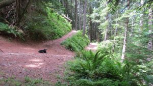 Day Trail which is designated a jeep, atv, horseback and hiking trail on its own. We are at this point about a quarter of a mile from Champion Creek Road.
Champion Creek and Champion Mines
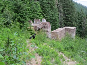 On our way home we stopped to look at the Champion Mine and here are some concrete piers that held the stamp mill equipment that serviced the mine.
More pictures of the mine area where the Forest Service is 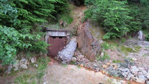 reclaiming the land. A hard thing to do as the water coming out of the mine has arsenic in it which leaches iron out of the ground and also the iron work used in the mine making everything it touches look rusty.
 Up above in this picture are two mining shafts from the Champion and actually two layers (galleries) above the main entrance which you can see just barely off to the right. I met the last care taker of the Champion mine before all building were torn down, circa 1964, and he mentioned that their were something like 7.5 miles of tunnelling in the Champion Mine. Can’t get their now as the water comes in faster than you can pump it out.
As with all of my posts here please click on any picture and you will be taken to the full album. Please leave a comment impressed or not.
Thanks for Looking, Ken
That looks like a really good hike. The closest to it I’ve done was in Bulgaria. The forest and scenery was quite similar. Most of the terrain was between 4500 and 6000 feet, thankfully for me mostly downhill. We ended up going along a narrow path under a small waterfall before a very steep downhill section dropping to 1700 feet where we retrieved one of our vehicles. A great walk.
This particular hike was around 2500 to 3500 feet, on leaving to get back to town we crested over two different saddles that were close to 5000 feet. Thanks for the comment. Ken
Hey Ken
I loved reading this article. The pictures and the commentary made you feel as tho you could be right there on the trail. It is always cool to explore and find something cool like the mines. It helps you learn a bit of history to.I think you might inspire some people to get out and explore.
Kevin
I like the exploring aspect of the hikes. We purposely look for out of the way trails that are remote enough that they get little use. At the same time they are higher in the mountains and it does get cold at times and if not prepared with proper clothing it can get nasty in a hurry. We do enjoy it though and are looking into our next walk about. Ken
Hi Ken, how very interesting, I absolutely love the pics, the wild flowers look so pretty. I used to love going hiking, unfortunately I am unable to do that now due to illness and really miss it when we go camping. I really like the way that you have linked the photo albums to the pics, I’ll have to check out how you have done this 🙂 You have a wonderful website, cheers Kerry
Thanks for your comments and hope you are getting better. putting a link on the photos is fairly easy. I put the pictures on google+ in the photo section as an album, then hit the share button and it will give you some more actions of which you want to hit the create a link button and it will build a link for the album for you. then you hit the copy button. At this point when you are building a post in wordpress there is an icon for insert link, here you left click the picture in question then go the insert link icon and left click it which will give you an new window next to picture, highlight what is in the window and do a paste of the link you just copied.
If you have any trouble doing this please send me message and I will give you better directions. You do it the same way you would highlight a phrase and link to the phrase.
At any rate I can help if you need more and thanks again for the comments Ken